The landscapes of the Republic of Congo
Despite its many natural assets, such as its tropical forest, fine sandy beaches and exceptional landscapes, the Congo has not yet become a popular tourist destination for travelers. Still little-known, it remains an exclusive destination for nature lovers and adventurers in search of unforgettable sensations.
Tourist activities in the Congo are still underdeveloped, but real efforts are being made to develop the tourism sector. For the moment, the majority of offers concern top-of-the-range services that guarantee the preservation of such a sensitive environment.
The Republic of Congo is a Central African country surrounded by 5 other countries : Angola, Cameroon, Gabon, the Democratic Republic of Congo and the Central African Republic. With a surface area of 342,000 km2 and located on either side of the equator, the Congo provides a wide variety of landscapes.
Between the hustle and bustle of the cities, the coastal landscapes and the calm of the forest, travelers can discover the lush Congolese countryside on a safari or a cruise on the Congo River. This is the richness of the Congo, a country with many atmospheres that will take you on a journey through many landscapes.
A region subject to geographical and climatic factors
The equatorial regions are subject to a hot, humid climate, characterized by abundant rainfall throughout the year. Located astride the equator, the Congo has an equatorial climate in the north and a more tropical climate in the southern parts of the country.
The equator crosses the country at the town of Makoua. This is why the north of the country is largely covered by dense, humid forest, symptomatic of an equatorial climate. While the southern part of the country has a sub-equatorial, tropical climate, with savannah and less dense forests.
Let yourself be carried away by the urban frenzy
With just over 5 million inhabitants, the population is predominantly urban. In fact, 60% of Congolese citizens live between Brazzaville and Pointe-Noire. In addition 10% of the population live along the railway line that links the two cities.
Congo has a population density of 16 inhabitants per square kilometer. The population is very unevenly distributed between the country’s different regions. The rural regions of the south are more densely populated than those of the north. Indeed, they are largely covered by the Congo forest, making them hostile areas.
There are few urban landscapes in the Republic of Congo, a country largely covered by natural areas. Although some areas can be described as human deserts. Brazzaville and Pointe-Noire stand out in this green setting. The two cities are immersed in a daily hustle and bustle that highlights Congolese culture. Thus they allows visitors to discover the Republic of Congo from a more urban perspective.
The gentle terrain of Congo-Brazzaville
The relief is moderate in the Congo, with no snow-capped mountain ranges as in some neighboring countries. Nevertheless, it is possible to distinguish 3 types of relief.
Firstly, the plains. These are located mainly in the west between the coast and the Niari valley and in the north-west of the country with the Congolese basin, a generally marshy setting.
The rest of the country is made up mainly of plateau and hills with an average height of around 860m. The regions with more moderate relief are generally made up of savannah or forest.
Finally, the medium mountains are located in the south-west of Congo Brazzaville. There, you will find the Chaillu massif whose highest points are Mont Bigourou and Mont de la Mayombe. The hills are located in the south-east of the country. The highest point in the Republic of Congo is Mont Nabemba, at 1,020m. It is located in the sparsely populated north-western region of the Sangha department.
A country with magnificent vegetation
In the Congo, the distribution of vegetation is influenced by the relief.
This is why, in the north, the vegetation consists essentially of an equatorial forest, the Congo forest. This is a tropical rainforest with flooded areas. Extremely dense, it is one of the last habitats of the pygmy populations.
Once south of the equator, the vegetation gradually thins out, giving way to the savannah with its tall grasses dotted with groves. The savannah covers 30% of the country and is mainly located between the Niari valley in the west of the country and the central plateau.
In the south-west, the forest takes precedence once again, mainly in the Mayombe chain and the Massif Chaillu. In the south-east, in the hills, there are large pastures.
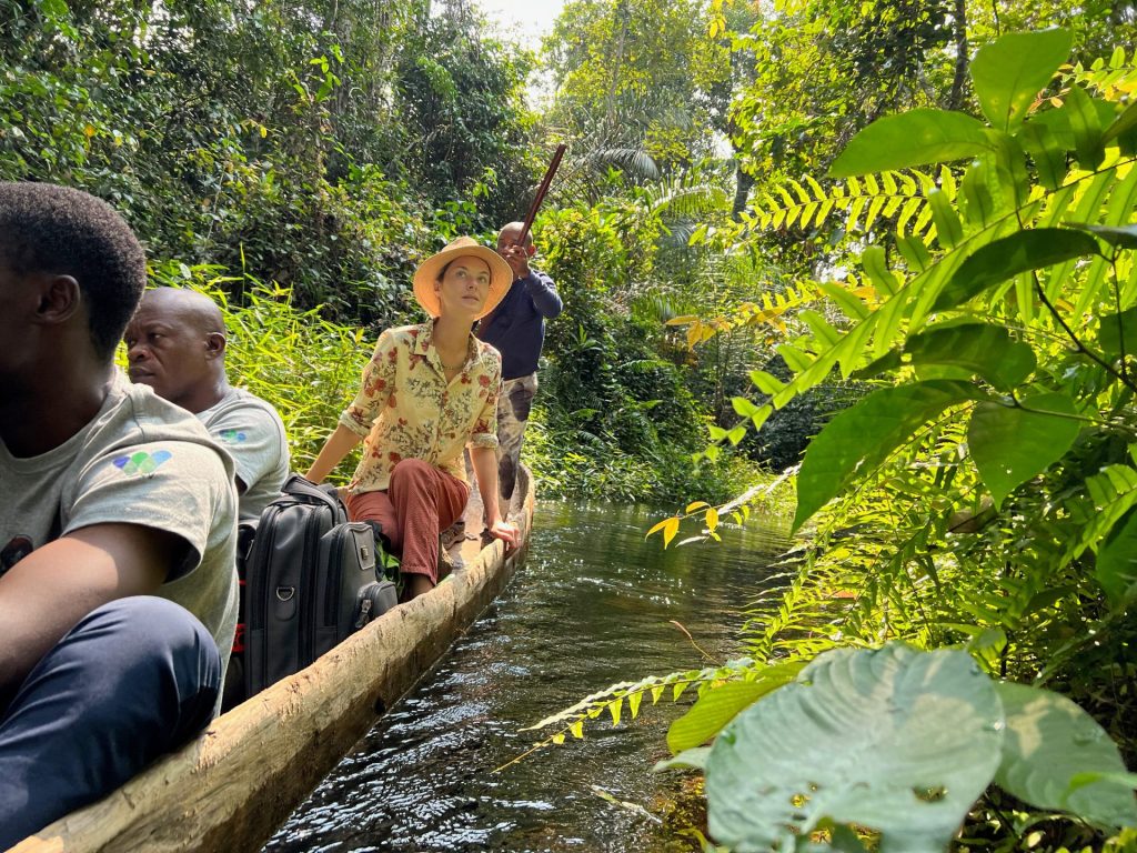
This vegetation is specific to the Congolese region. This is why a safari or cruise in the Congo is an opportunity to plunge into exotic and exhilarating settings and reach the heart of Central Africa, deep and wild.
The equatorial forest, emblem of Central Africa
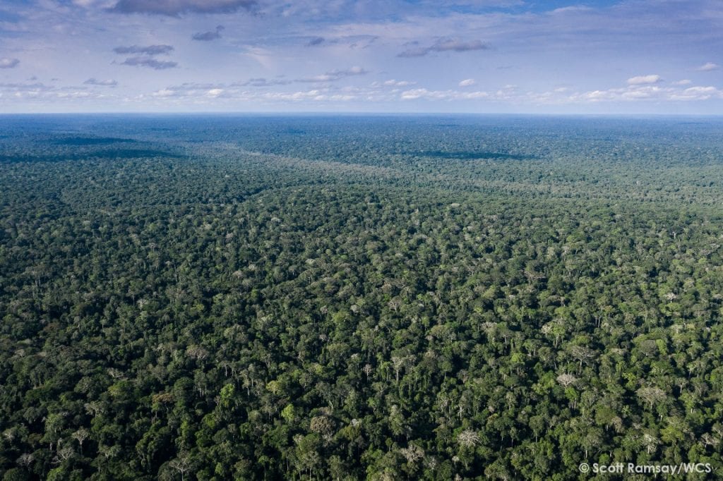
Around two-thirds of Congo Brazzaville is covered in forest. This represents 21 million hectares of forest cover. The remaining third of the country is divided between savannah and forest massifs. A real carbon sink, the Congo forest is characteristic of the tropical rainforests found in equatorial regions.
Two types of landscape predominate in the forest. The dry forest, which is lighter, with trees over 40m tall and a rich undergrowth and the flooded forest, characterized by its marshy waters, high density and low trees. It is located in alluvial areas, often close to watercourses.
Congo Brazzaville is the 15th most forested country in the world, covering 70% of its territory.
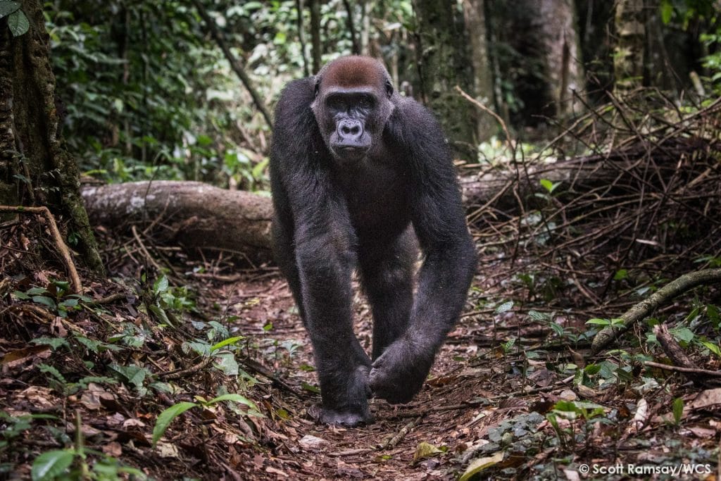
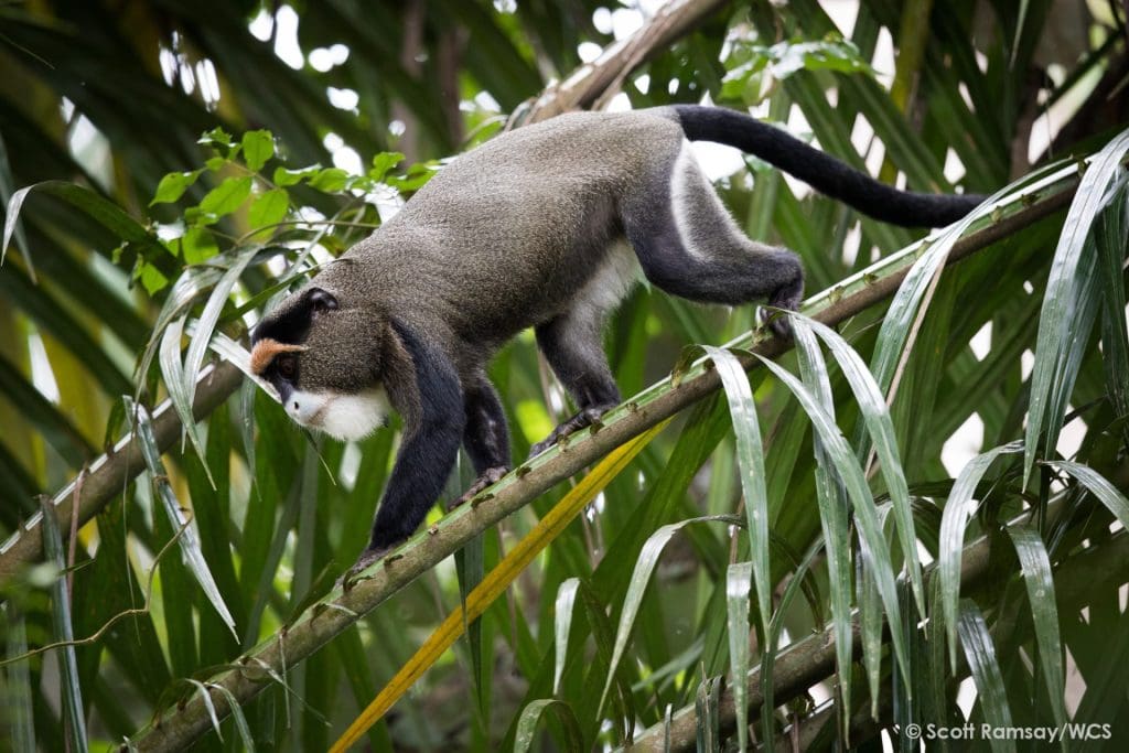
This dense forest cover is home to over 400 species of mammals, as well as almost 10,000 plant species.
The Congo has 4 national parks, all located in the Congo Forest. The purpose of these parks is to ensure the preservation of the Congolese flora and fauna. These protected areas are home to endangered species such as antelopes, hippopotamus, buffalos, gorillas and chimpanzees.
Since the early 2000s, the Congo has been conducting joint operations with UNESCO to maintain and preserve the environment. In particular, the civil authorities ensure that the laws on logging and poaching are respected. In all, 13% of the country’s surface area is classified as a protected area. Action to conserve natural sites primarily concerns national parks. This is why the Sangha trinational site has been a UNESCO World Heritage Site since 2012.
Congo, a country of land and water
Congo’s equatorial climate makes it a humid country. The region is watered all year round by abundant tropical rainfall, which feeds the rivers and ponds.
The Congo also has an extensive hydrographic network. The country is crisscrossed by rivers and is home to two river basins. To be precise : the Congo Basin in the north and the Kouilou Basin in the south. The country is also bordered along its entire eastern border by the Congo River, Africa’s second largest river. In addition, the region is crossed by one of its main tributaries, the Sangha River.
These equatorial features offer travelers the chance to discover unique landscapes that are unique to equatorial countries. Those particular conditions provide a home for an extremely well-developed fauna.
The aquatic landscapes are particularly pleasant to discover on a safari cruise.
A paradise coast
In the south-west of the country, the Republic of Congo has access to the Atlantic Ocean with a 170 km-long coastline. The coast, lined with lagoons and mangroves, is an ideal destination for enjoying fine sandy beaches. Pointe Indienne beach being one of the best known.
Also on the coast is Pointe Noire, the country’s second-largest city and the economic capital of Congo Brazzaville.
Further south, still on the coast, lies the Mayombe region, with its craggy reliefs sometimes reaching 800m in height. At the heart of this massif lies Mount Berongou, culminating at 903m.
This oceanic landscape is not what you expect when you think of Central Africa. And yet the Congo is both a Central African country and a destination lined with heavenly beaches.